


Man carries his son in his arms during a daily walk at his property in Queensland, Australia that suffered from the country's longest drought on record. Almost 80% of the region was affected. The government approved emergency drought relief to assist eligible farmers. (Photo by Lisa Maree Williams/Getty Images)
An unusually quiet period for cyclones in the Australian region may come to an abrupt end within days as forecasters predict a major storm will develop off the Kimberley by Friday...
Any breakup of the abnormally warm waters off northern Australia would be welcomed, as much of the Great Barrier Reef off central and north Queensland faced a "warning" level risk of coral bleaching, according to the US National Oceanic and Atmospheric Administration's Coral Reef Watch service.
Phil Klotzbach, a US-based storm researcher, said the whole southern hemisphere had not had a hurricane-strength storm for 275 days, the longest absence since 1974.
"There have only been two named storms so far in the southern hemisphere season and zero hurricane-strength storms," Dr Klotzbach, a research scientist at Colorado State University, said. "On average, we should have had 10 named storms and five hurricanes so far."
The US uses a slightly different rating system for storm intensity than Australia's Bureau of Meteorology, and dubs cyclones hurricanes if they occur in the north-east Pacific and Atlantic, or typhoons in Asia.
Only 2 named storms in S. Hemisphere hurricane season so far in 2016/17 - the fewest on record. Prior record low to date is 5. Average is 10
Still, the bureau also counted the 2015-16 season as the quietest in reliable records going back over four decades of the satellite era.
Last summer had just three named storms compared with an average of about 11, Blair Trewin, the bureau's senior climatologist, said.
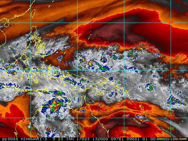
A satellite image released by NASA shows super cyclone Winston as it spun over Fiji's region. Photo: NASA
"It was a record low season," Dr Trewin said, adding "below average cyclone season are fairly typical of El Nino [periods]".
During El Ninos, easterly winds tended to weaken or reverse, and storms and other rain shifted eastwards away from Australia. One such storm was super cyclone Winston which smashed into Fiji last February but had weakened to a tropical depression by the time it entered Australia's zone.
Since July, the start of the 2016-17 cyclone season, there had been just one cyclone in the Australian region, the weak Yvette storm that weakened below cyclonic-strength before it made landfall.
"It's fairly low, but it's still early days," Dr Trewin said, adding February and March were often the most active months for cyclones forming near Australia.
Philippe Caroff, operations manager at France's Regional Specialised Meteorological Centre for the South-West Indian Ocean based in La Reunion, said the cyclone "situation is indeed clearly exceptional", particularly in his region.
"Zero tropical cyclone activity since October and [there's] the strong likelihood of zero activity in January which has never happened," Mr Caroff said.
Storm brewing
The drought might break as soon as Friday, as a deep low pressure system over the Top End was likely to shift westwards over open water and strengthen to cyclone strength, said Neil Bennett, a manager at the bureau's Perth office.
This storm might run parallel to the West Australian coastline but "probably close enough to cause significant issues along the coast", Mr Bennett said.
Towns such as Kununurra had already set January rainfall records – 385mm so far, topping the previous high of 358mm – and might cop more rain out of the coming storm, he said.
"It's been a significant wet season even without a tropical cyclone making landfall," Mr Bennett said.
Coral risk
People off northern Queensland might not mind a bit of storm activity after another quiet season for cyclones.
The remnant of cyclone Winton last February helped to provide the mixing of cooler waters and cloud cover that spared the southern reaches of the Great Barrier Reef from the ravages of the region's worst coral bleaching on record.
Scientists said the current conditions, while worrying, were not yet near the thresholds reached during last year's bleaching catastrophe that resulted in large-scale devastation north of Cairns.
Still, several sites with long-term monitoring by the Australian Institute of Marine Science, such as Davies Reef or Hardy Reef, showed water temperatures were running about a degree above average.
The largest threat of a repeat bleaching would likely come in the last two weeks of February when the corals were most at risk, one researcher said.
Quiet on the storm front
Until this year, no season in the southern hemisphere had gone beyond January 13 without a hurricane-strength storm, roughly equal to a category-3 event on Australian ratings,according to Dr Klotzbach.
Conditions in the northern hemisphere had been roughly in line with long-term averages.
Still 0 Southern Hemisphere hurricanes in 2016/17 season - the latest date for first hurricane on record. Prior latest date was 1/13/1988.
While it was not clear what had caused the quiet period across the southern half of the planet, there were a few possible drivers.
"The south Indian Ocean has been relatively cool compared with normal as of late, and there has also tended to be sinking motion in that region," reducing the chances of storms forming, Dr Klotzbach said.
"The more surprising thing is that the whole southern hemisphere is concerned," Mr Caroff said.
"With rising motion over the Australian region we should have at least expected some [cyclone] activity around Australia, which is not really the case," he said, adding that cyclones may instead have been displaced southwards to become so-called "landphoons", or inland storms, over Australia.
Dr Trewin noted that 2005-2006 had also started relatively quietly but ended with a bang.
Cyclone Larry made landfall in Queensland in March 2006 as a category 4-strength storm, leaving a damage bill of about $1.5 billion.
A month later, cyclone Monica brewed off Papua New Guinea and slammed into Cape York as a category-5 storm, one of the strongest recorded to hit Australia.

Peter Hannam
Follow Peter Hannam on Twitter and Facebook.
source: http://www.smh.com.au/
original story HERE
New Climageddon book: Click here for Information on the new Climageddon book about the global warming emergency and what you can do.
Share Blog Post: If you would like to share this blog post on Facebook or in other ways go back to the original short version of this blog posting and look to lower right for the large green Share button.
Get Global Warming Blog RSS Feed: Sign up for free Global Warming Blog RSS feed by clicking here.
Sign Petition: Sign petition to declare an international global warming State of Emergency, click here!
To see our: most current positions, opinions, comments, agreement or disagreement with this article, and/or possible criticisms related to the subjects or facts in the above article, click here.
To help do something about the climate change and global warming emergency, click here.
Sign up for our free Global Warming Blog by clicking here. (In your email, you will receive critical news, research, and the warning signs for the next global warming disaster.)
To share this blog post: Go to the Share button to the left below.
Be the first to comment
Sign in with